 Before VORs, GPS, and glass panels, pilots navigated by listening. The low-frequency four-course radio range—commonly called the A-N range—was the backbone of instrument navigation in the United States from the late 1920s through the early 1950s. It was crude by today’s standards, yet remarkably effective at getting airplanes where they needed to go.
Each station transmitted two interlocking figure-eight patterns. One radiated the Morse code letter “A” (dot-dash); the other radiated “N” (dash-dot). Where the patterns overlapped, the signals merged into a continuous 1,020-hertz tone. That narrow equisignal zone—typically three to four degrees wide—defined the course, or “beam.” Off the beam, the pilot heard a clear A or N, telling him which way to turn to regain the steady tone. Station identification interrupted the signals twice a minute so the pilot could confirm he was listening to the correct range.
Pilots “flew the beam” by keeping that monotone in their headphones for hours. Approaching the station, the signal grew louder until the aircraft entered the cone of silence directly overhead, then the opposite beam appeared as they continued outbound. Complex orientation procedures existed for pilots who became lost in an A or N quadrant: a series of timed turns and signal-strength comparisons to identify which of the four legs they had intercepted and which way led to the station.
The system had serious limitations. Low-frequency signals suffered from static, especially during thunderstorms when guidance was likely needed most. Nighttime skywave interference and terrain reflections could bend or create false courses. Ambiguity was constant—pilots often knew they were on a beam but not which of the four. Continuous headphone listening was fatiguing, and the equipment offered no distance information beyond the cone of silence. Yet for all its shortcomings, the A-N range worked. Airways were built around the beams. Airmail and early airline schedules became reliable. Instrument approaches to moderate ceilings were flown using the same aural cues. Generations of pilots developed a practiced ear that could hold a course within a couple of miles at 100 miles from the station.
We are fortunate those days are behind us. Today, a pilot can load a direct-to, watch a moving map, and cross-check GPS against VOR or ILS with a glance. Precision, redundancy, and situational awareness are orders of magnitude better. Still, the A-N range deserves respect. It proved that disciplined listening and clear procedures could keep airplanes safe when the weather closed in. Modern tools make the job easier and safer, but they rest on foundations laid by pilots who once steered by the simple difference between a dash-dot and a continuous tone.
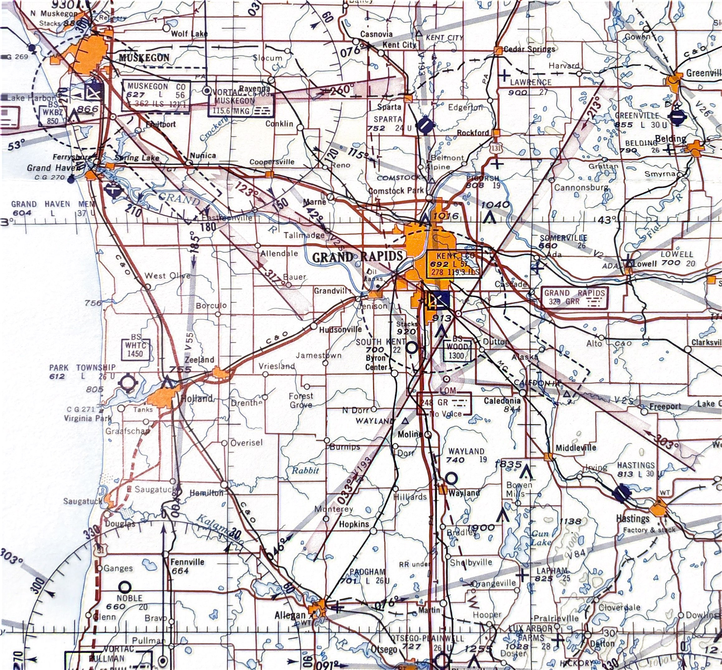
You can even see in this chart from 1963 around the Grand Rapids, MI area that courses were still on the charts back then!
Most of the pilots flying nowadays have never seen, or especially heard, an actual A-N range. And that got me curious, so I put together a little sample demonstrator program that you can play with to see what it might have sounded like for all of us fortunate enough to never have to navigate using them.
Check it out and be thankful for our modern tools. Heck, I would take an ADF over this every day! Oh, and yeah, a GPS too.
Be sure to drag the little airplane around the map to hear the different sounds you would get based on where you were in relation to the beam.
Click here to show this A-N Range simulation in its own page as a standalone.