Wow. Less than two weeks to launch.The goal is launch on Sunday, May 3rd.
I am pretty certain it is going to by very fast and there is much yet to do. Much has been done, but a trip like this is something that has lots of moving parts and complex requirements for a first time attempt at completing a flight across to major continents and through multiple countries.
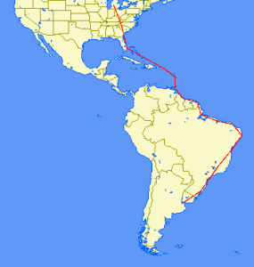 We think we have settled on a route. The map to the right is what is planned. I know it looks pretty granular at this scale, but that kind of puts into perspective the length of the trip. We have settled on the Caribbean route then through Guyana, over Suriname to French Guiana, then lots of Brazil, over Uruguay and into Argentina to the end.
The entire route is broken out in the table below.
The short of it is that we expect around 48 hours of flight, 6730 miles to be traveled, and over $6,000 of gas burned along the way.
There is much left to be done, finish the annual, finish VISA applications for Brazil (its is a little scary that you have to send your actual passport through the mail to the consulate to get this done, I hate having my passport out of my personal control) and Argentina (the only two countries that require them for this trip), get a Yellow Fever vaccination, coordinate funding with the buyers, finish working with handlers for each landing location, oh, and hope for very good weather to not make us get delayed along the route. That will be a major factor no doubt. Hoping we are on the good side of mother nature.
Much of the routing was chosen based on customs facilities, hours of operation, availability of fuel services, range of the aircraft fuel reserves (the plane has approx 5 1/2 hours of fuel so we wanted to always leave 2 hours of fuel reserve if possible), and closing times of services.
There are days we probably could fly more if weather cooperated, but the times of operation of customs facilities and places we wanted to avoid having to stay overnight and incur further costs were definitely a factor. So, we came up with our planned route.
The route is as follows: (Click here for a much more readable pdf of the route)
| Travel | Flight | ICAO | |||||
| Day | Route | Time | APT ID | City | Country | ||
| 3-May | 24C – KGSP | 3.5 | KGSP | Greenville, NC | USA | ||
| 3-May | KGSP – KFXE | 3.5 | KFXE | Ft. Lauderdale, FL | USA | ||
| 4-May | KFXE – zbv – zqa – btler – pvn – MBPV | 3.5 | MBPV | Providenciales International | Turks and Caicos | ||
| 4-May | MBPV – gtk – idaho – sju – stt – TISX | 3.5 | TISX | Henry E Rohlsen (St. Croix) | USA | ||
| 5-May | TISX – anu – ptp – TFFF | 2.5 | TFFF | Le Lamentin | Martinique | ||
| 5-May | TFFF – bne – gnd – TTPP | 2 | TTPP | Piarco | Trinidad and Tobago | ||
| 6-May | TTPP – lepod – SYCJ | 2.5 | SYCJ | Cheddi Jagan International | Guyana | ||
| 6-May | SYCJ – zy – SOCA | 2.5 | SOCA | Rochambeau – Felix Eboue | French Guiana | ||
| 6-May | SOCA – oia – amp – SBMQ | 2 | SBMQ | Macapa Intl Airport Information | Brazil | ||
| 7-May | SBMQ – bel – SBSL | 3 | SBSL | Sao Luis/Marechal Cunha Machado Airport Information | Brazil | ||
| 7-May | SBSL – pnb – urt – SBFZ | 2 | SBFZ | Fortoleza | Brazil | ||
| 7-May | SBFZ – mss – cpg – SBRF | 3.5 | SBRF | Recife International Guararapes-Gilberto Freyre | Brazil | ||
| 8-May | SBRF – mce – aru – svd – SBSV | 2.6 | SBSV | Salvador | Brazil | ||
| 8-May | SBSV – ylh – cnf – SBBH | 3.5 | SBBH | Belo Horizonte | Brazil | ||
| 8-May | SBBH – utger – bco SBSP | 2 | SBSP | Congonhas – Sao Paolo | Brazil | ||
| 9-May | SBSP – nigba – ctb – ljs – SBPA | 3.5 | SBPA | Porto Alegre/Salgado Filho | Brazil | ||
| 9-May | SBPA – bge – dur – SAEZ | 3 | SAEZ | Buenos Aires | Argentina | ||
If you want to know the route with ICAO airport codes, you can cut and past this into a flight planner to have it pull up the route (this is just the airports, not the fixes and VORs/ADFs along the route that will be used):
24C KGSP KFXE MBPV TISX TFFF TTPP SYCJ SOCA SBMQ SBSL SBFZ SBRF SBSV SBBH SBSP SBPA SAEZ
For the route with all fixes, here it is:
24C KGSP KFXE zbv zqa btler pvn MBPV gtk idaho sju stt TISX anu ptp TFFF bne gnd TTPP lepod SYCJ zy SOCA oia amp SBMQ bel SBSL pnb urt SBFZ mss cpg SBRF mce aru svd SBSV ylh cnf SBBH utger bco SBSP nigba ctb ljs SBPA bge dur SAEZ
To get a good idea of the routing, check it out on SkyVector or use Great Circle Mapper website.
SkyVector can be used to see VFR/IFR routing charts to get a better detail of the route.
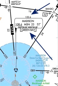
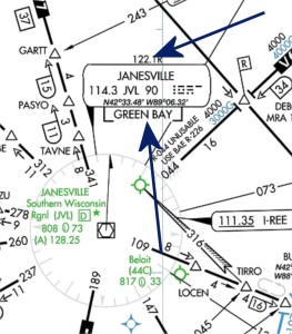 Contacting Flight Service can take a little more work to find the correct frequency. A pilot can find flight service frequencies on nearby VOR identification boxes on IFR en route charts. Note that if a frequency is listed and it does not have a “R” after it, it means that the frequency is “duplex” and the pilot can talk and receive communications with Flight Service. See the example to the right at Madison where the frequency you would use in that area is 122.6. If, like in the example by Janesville, there is a “R” after the frequency, it means that a pilot would transmit on that frequency to Flight Service, but would have to listen for a reply from Flight Service over the VOR frequency. In this case, the pilot would transmit on 122.1 and listen over the VOR frequency of 114.3. In both instances you will be able to determine which flight service station you are talking to by looking to the name that is below the VOR identification box, in these examples it would be “Green Bay Flight Service.”
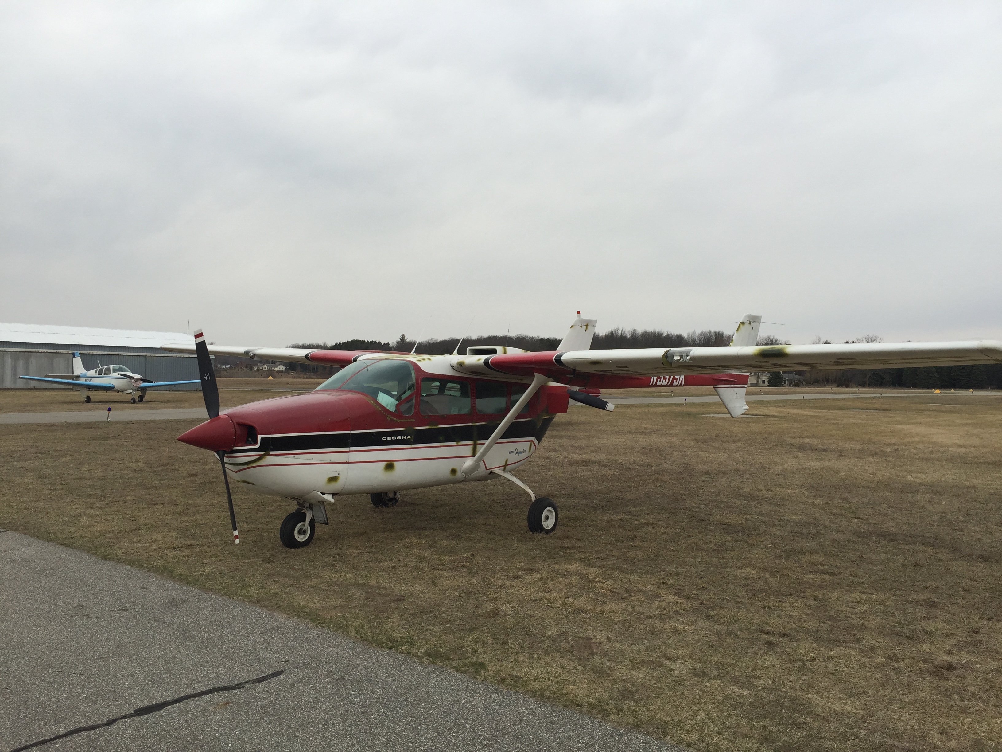
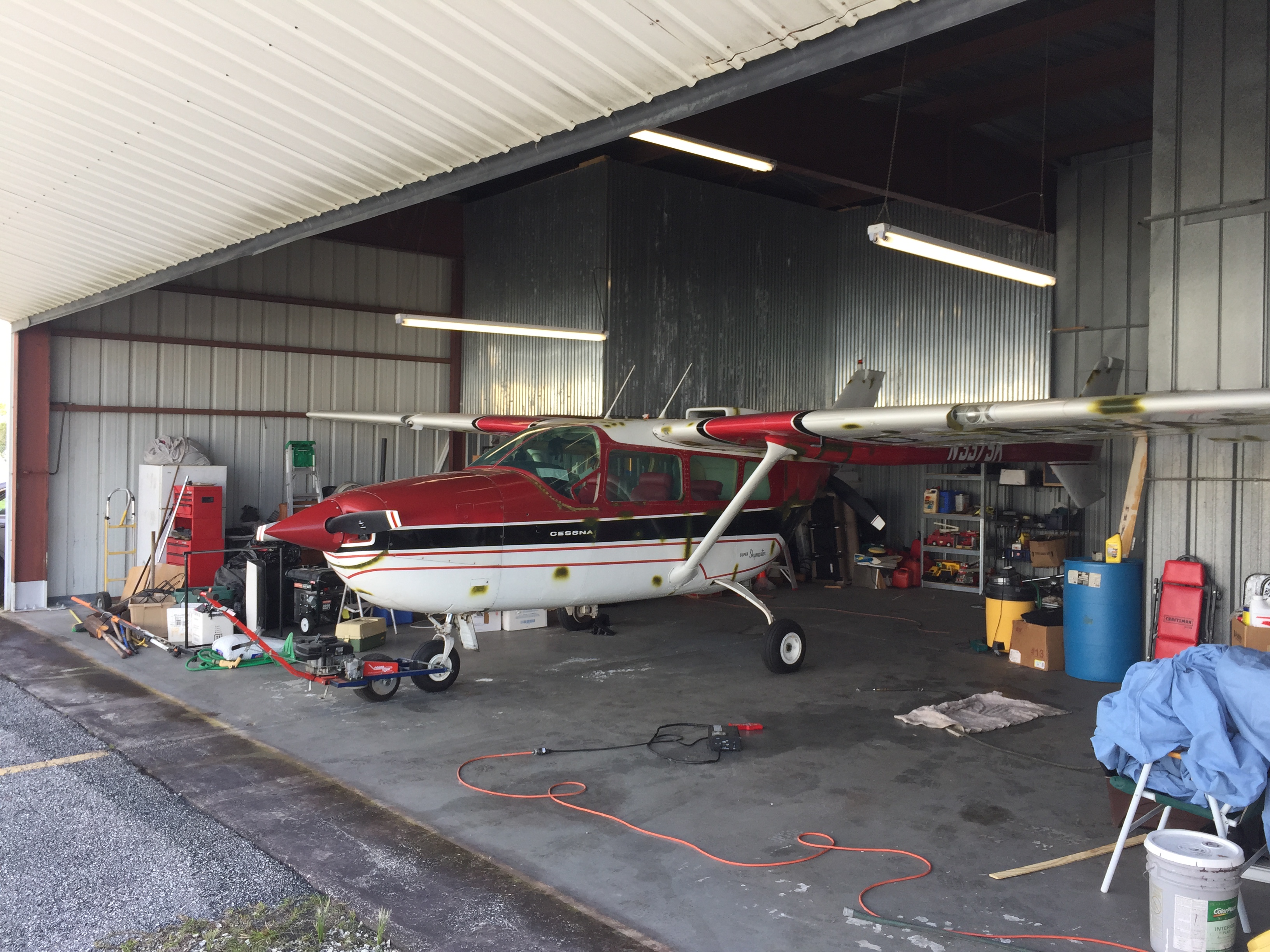
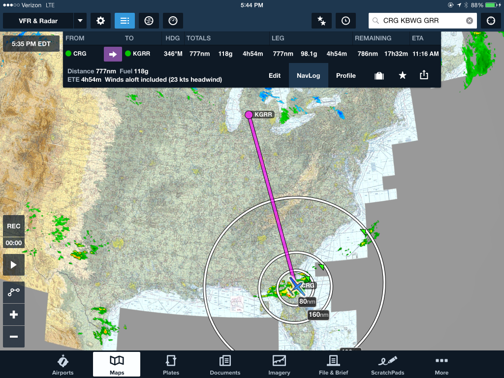
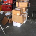 Then when I got to Jacksonville, I went to the plane, packed all the boxes that go with it of logbooks, extra seats, etc., and then repositioned the aircraft out of the previous owners hangar to an FBO that will be able to pick me up in the morning from a new hotel room in Jacksonville for the night to leave as soon as I can in the morning.
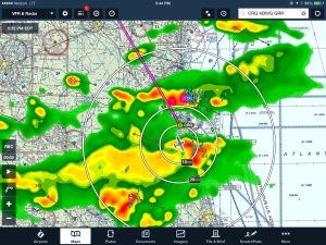 Next time I’ll trust my gut about taking my bags with me. Would have saved me at least 6 hours of travel today. Maybe instead of another night here I could have been on the way home already. That being said, it is entirely possible that no matter what I wouldn’t have been on the way fast enough to beat some of the weather that was in the area.