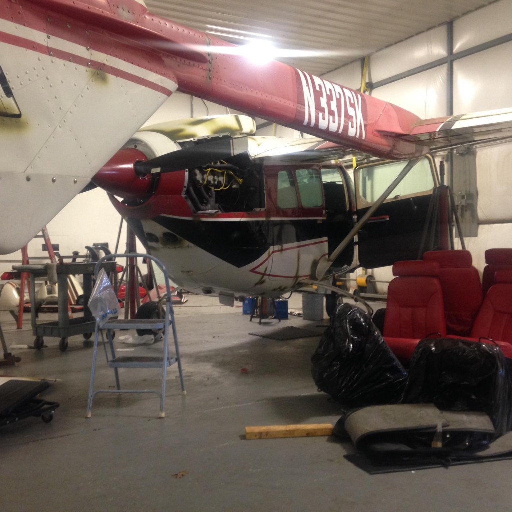
Ferry flight for 337 on hold…maybe to revive at a later date….

2015-04-24 09.53.00Well, with more information in hand, the trip may happen in the future. While a number of things remained outstanding for our original proposed date of departure, the day came and went without solution, for good reason.

We have since had contact from the receiver of the aircraft who has experienced a medical issue that is the cause of the delays and will require reconsideration of the delivery to another date. So, for now, it is on hold, but in another month we will revisit the potential to revive the trip for my co-pilot and myself.

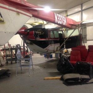
In the mean time, the annual is progressing. Although, as we wait for some parts for the fuel gauges, it would have been another reason for a delay in the original delivery schedule. We expect that the parts will arrive in the next week and the annual will be able to be completed and some test flights can take place.
Yellow FeverWe also have had to do a couple other things in the mean time.

I now have a Yellow Fever vaccination that had to be completed. It isn’t so much that I need the vaccination to go to the countries that we are planning on travelling through, but it is likely that if I have traveled through these countries proof of the vaccination will be required to come back through the customs to get home. So, I am now vaccinated.

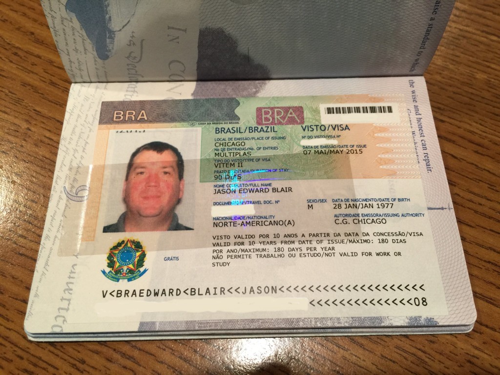
Another piece of the puzzle that needed to come together was the receipt of the travel VISA for Brazil. This arrived a few days ago and we have held off doing the one for Argentina just yet. That one can be done online, but the Brazil one took all of the 10 business days that they said it would to get back to me. Those were 10 long days of worrying about the fact that my passport was not in my possession.

jbvisabr

I am sure people that do this all the time have many of the things I am doing now already done, but for a first time long distance ferry, there are lots of things that need to be done.

A few other details we have pulled together since my last post include services for  handling services and enroute airport services. Fuel quotes at most locations have been secured, and a large FBO chain in Brazil and the handlers we are using are coordinating our fuel supply along the route. We get pretty spoiled here in the United States by being able to fly around and just whip out our credit card and pay for the fuel.

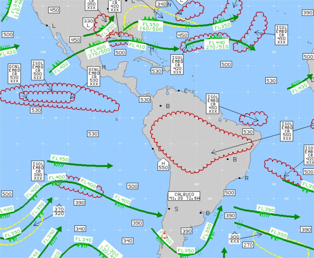
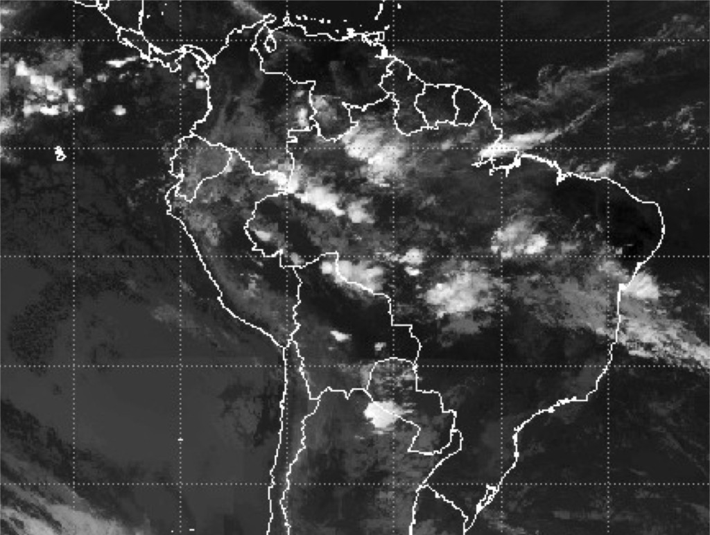
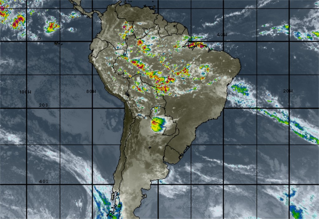
We have been starting to compile weather resources to look at along the route and have pretty much come down to the fact that we will be self-briefing using resources. There isn’t a Lockheed-Martin Flight Services that covers this route. Notams will be pulled from the U.S. Government NOTAMs service (https://www.notams.faa.gov/dinsQueryWeb/) and we can do the same for METARs and TAFs at http://adds.aviation weather.gov.

skyvectorlogoSomething I hadn’t noticed before, and am pretty intrigued by, is that SkyVector has a great weather overlay that can be used when in range of an internet connection that allows METARs, TAFs, and satellite and radar information to be viewed on VFR and IFR charts. I have no doubt that this is a resource we are going to be using.

What I am learning through this entire process is that there is a GREAT DEAL that needs to come together to make a trip like this happen. You can’t just decided to do it the next day. And it is expensive.

Things like getting VISAs can take weeks, getting fuel handlers set up can take weeks, and finding the right route can take weeks. The simple fact is that someone endeavoring to do a trip like this in a light aircraft probably needs to start planning 4-6 weeks out. But at some point, you have to pull together all that you have done, and launch. I am certain even with best laid plans there will need to be modifications along the route. I promise I will tell you all the good and bad as we go if we end up having the trip become  a go in the next couple of months..

While the delay wasn’t in our original plan, it does offer time to get a few more ducks in a row if the trip revives itself.

337 Trip Plug Pulled?

Let's pull out the standby power supply.

With less than a week to go before the proposed departure, the question of is it time to pull the plug on the trip looms.

A pilot must know when to say no right?

And if too many things are not going in the right direction, not ready, and are creating hurdles to completing the task at hand, perhaps it is time to bow out of completing the task.

2015-04-24 09.53.00The annual is progressing well on the plane, although there are a couple parts that still need to come in this week if the aircraft is to be ready to fly next Sunday. But that is probably manageable.
What is not manageable is the rest of the logistics that are yet to be accomplished.

At the time of writing this, we still do not have an answer from the intended recipient of the aircraft of how they will provide an updated GPS database that would include coverage for South America (obviously a pretty big part of the trip) or provide charts (we proposed a Jeppesen digital subscription with no answer) to cover the routes.

Bigger hurdles are the fact that we do not have documents required for the flight. We have already applied for and expect the US Customs sticker and the FCC Radio License for the aircraft to arrive this week, but we are missing a couple other critical things. The biggest is proof of insurance with liability waivers for each country of intended landing. This is required to show each place of landing upon entry for customs. And I must say I don’t think they have been procured yet, because two days ago the recipient called into question the route that we proposed.

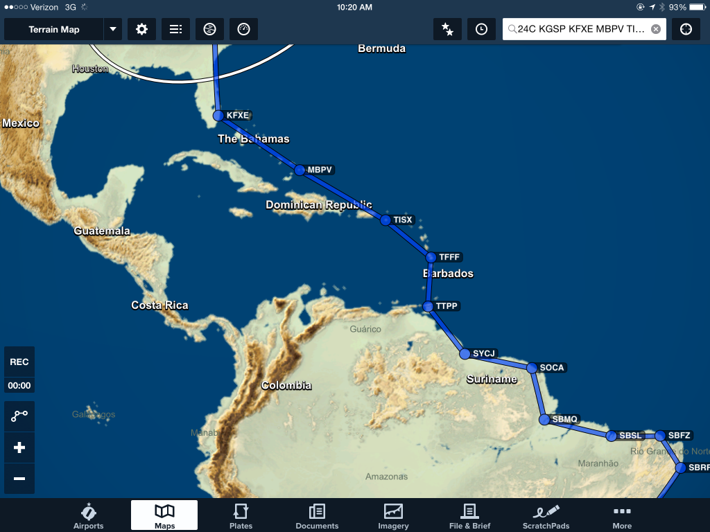
Our route proposed (see the last post that has this route at https://jasonblair.net/?p=807) would take us from Ft. Lauderdale through Caribbean, down to Trinidad, and through north eastern South America to coastal Brazil. The entire purpose of this route (as you can see it below) is to avoid difficult areas to fly through or areas that are really no-fly zones for U.S. Citizens (think Cuba and Venezuela).

2015-04-24 10.20.13

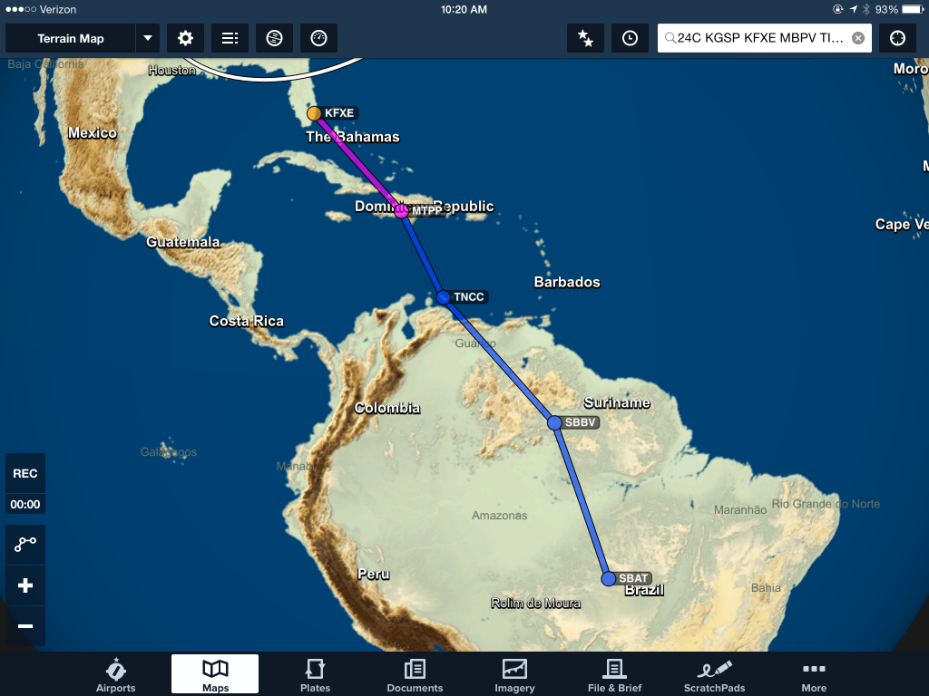
But a couple days ago, the recipient suggested we change routing to do exactly that. Rerouting from Ft. Lauderdale directly (632 miles) to Port Au Prince, Haiti (which required passing through the Cuba FIR), then to Curacao (a 429 mile leg) and then overflying Venezuela on a whopping 746 mile leg into much higher terrain and remote areas of Brazil. This would be followed by an equally daunting 810 mile leg to the next stop they proposed in Brazil. The goal to save few hundred miles of flight and the cost of the gas for the flight. See the route below.

2015-04-24 10.20.20

This comes with multiple problems. The first is obviously coordination of flight through the Cuban FIR, followed by over 400 miles of open water flight, then the problem of flying over Venezuela, and very long legs over jungle and much less hospitable terrain than the original route we had proposed. For me, Cuban overflight is a no-go. Over 400 miles of open water is not a good choice when a more easterly route wouldn’t add much overall distance and would allow a pilot at almost all points to stay in established IFR routes and within striking distance of land at almost all points of the flight. The long legs into and in Brazil stretch beyond logical distances for this aircraft. Assuming normal fuel burns at an altitude of 10,000 MSL the aircraft might be able to make between 900-950 miles of flight before it runs out of gas. 746 miles and 810 miles not only stretch this endurance beyond a good practice range, but they certainly would not allow for IFR fuel reserve minimums to be met, especially if an alternate airport were required at any point. This would leave a pilot to assume that the entire leg could be completed VFR and that weather over a 5 hour flight leg would not change at all. Also probably not a good risk to take.

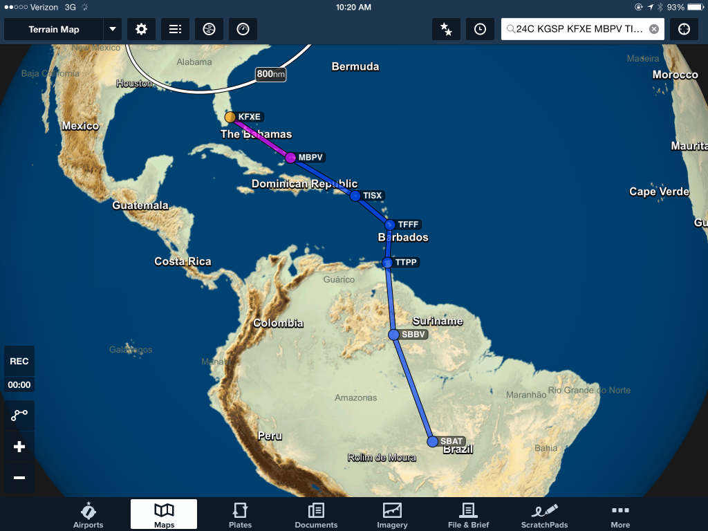
So, I proposed an alternate route, one that takes us through the islands as originally planned, and where we would deliver the aircraft to Trinidad where a pilot more comfortable (and able to overfly Venezuela) might meet us and takeover the remainder of the flight. The difference in what I proposed to what they suggested is less than 200 miles of flight.

2015-04-24 10.20.32

Another option is to deliver the aircraft back to Ft. Lauderdale, where a different pilot of their choosing might take over and fly the route they have proposed. Or, perhaps they will choose to have a different pilot all together fly the entire route from Michigan.

On top of routing questions, there still is outstanding the question of how the recipient would provide funds for the flight to be completed. With less than a week to the proposed departure, timing to allow for any transfer of funds becomes improbable to be completed considering the international transfer requirements. Reality begins to meet logistics planning and it becomes unlikely that even if all the other questions could be resolved rapidly, that the departure date could be met as planned. And considering other time commitments I have in upcoming weeks, even a short delay in departure would mean that I must bow out of the trip. The time had been dedicated over a month ago, but the logistical requirements have not been met in the interim.

So, the question is, does the plug need to be pulled on this trip at this time?

A pilot must know when to say that a trip cannot be completed in a manner in which they are comfortable, consider safe, and could be completed appropriately. Barring some major changes, at this time, I am at that point.

The exercise has been worthwhile, and I have learned much through the process, but for now, the trip is on hold. Perhaps I will have an opportunity to complete part of it or another such trip in the future.

Less than Two Weeks Out for Ferry Flight…and a Route

Wow. Less than two weeks to launch.The goal is launch on Sunday, May 3rd.

I am pretty certain it is going to by very fast and there is much yet to do. Much has been done, but a trip like this is something that has lots of moving parts and complex requirements for a first time attempt at completing a flight across to major continents and through multiple countries.

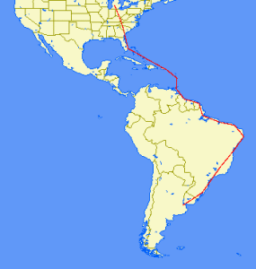
gcmapWe think we have settled on a route. The map to the right is what is planned. I know it looks pretty granular at this scale, but that kind of puts into perspective the length of the trip. We have settled on the Caribbean route then through Guyana, over Suriname to French Guiana, then lots of Brazil, over Uruguay and into Argentina to the end.

The entire route is broken out in the table below.

The short of it is that we expect around 48 hours of flight, 6730 miles to be traveled, and over $6,000 of gas burned along the way.

There is much left to be done, finish the annual, finish VISA applications for Brazil (its is a little scary that you have to send your actual passport through the mail to the consulate to get this done, I hate having my passport out of my personal control) and Argentina (the only two countries that require them for this trip), get a Yellow Fever vaccination, coordinate funding with the buyers, finish working with handlers for each landing location, oh, and hope for very good weather to not make us get delayed along the route. That will be a major factor no doubt. Hoping we are on the good side of mother nature.

Much of the routing was chosen based on customs facilities, hours of operation, availability of fuel services, range of the aircraft fuel reserves (the plane has approx 5 1/2 hours of fuel so we wanted to always leave 2 hours of fuel reserve if possible), and closing times of services.

There are days we probably could fly more if weather cooperated, but the times of operation of customs facilities and places we wanted to avoid having to stay overnight and incur further costs were definitely a factor. So, we came up with our planned route.

The route is as follows: (Click here for a much more readable pdf of the route)

Travel Flight ICAO
Day Route Time APT ID City Country
3-May 24C – KGSP 3.5 KGSP Greenville, NC USA
3-May KGSP – KFXE 3.5 KFXE Ft. Lauderdale, FL USA
4-May KFXE – zbv – zqa – btler – pvn – MBPV 3.5 MBPV Providenciales International Turks and Caicos
4-May MBPV – gtk – idaho – sju – stt – TISX 3.5 TISX Henry E Rohlsen (St. Croix) USA
5-May TISX – anu – ptp – TFFF 2.5 TFFF Le Lamentin Martinique
5-May TFFF – bne – gnd – TTPP 2 TTPP Piarco Trinidad and Tobago
6-May TTPP – lepod – SYCJ 2.5 SYCJ Cheddi Jagan International Guyana
6-May SYCJ – zy – SOCA 2.5 SOCA Rochambeau – Felix Eboue French Guiana
6-May SOCA – oia – amp – SBMQ 2 SBMQ Macapa Intl Airport Information Brazil
7-May SBMQ – bel – SBSL 3 SBSL Sao Luis/Marechal Cunha Machado Airport Information Brazil
7-May SBSL – pnb – urt – SBFZ 2 SBFZ Fortoleza Brazil
7-May SBFZ – mss – cpg – SBRF 3.5 SBRF Recife International Guararapes-Gilberto Freyre Brazil
8-May SBRF – mce – aru – svd – SBSV 2.6 SBSV Salvador Brazil
8-May SBSV – ylh – cnf – SBBH 3.5 SBBH Belo Horizonte Brazil
8-May SBBH – utger – bco SBSP 2 SBSP Congonhas – Sao Paolo Brazil
9-May SBSP – nigba – ctb – ljs – SBPA 3.5 SBPA Porto Alegre/Salgado Filho Brazil
9-May SBPA – bge – dur – SAEZ 3 SAEZ Buenos Aires Argentina

If you want to know the route with ICAO airport codes, you can cut and past this into a flight planner to have it pull up the route (this is just the airports, not the fixes and VORs/ADFs along the route that will be used):

24C KGSP KFXE MBPV TISX TFFF TTPP SYCJ SOCA SBMQ SBSL SBFZ SBRF SBSV SBBH SBSP SBPA SAEZ

For the route with all fixes, here it is:

24C KGSP KFXE zbv zqa btler pvn MBPV gtk idaho sju stt TISX anu ptp TFFF bne gnd TTPP lepod SYCJ zy SOCA oia amp SBMQ bel SBSL pnb urt SBFZ mss cpg SBRF mce aru svd SBSV ylh cnf SBBH utger bco SBSP nigba ctb ljs SBPA bge dur SAEZ

To get a good idea of the routing, check it out on SkyVector or use Great Circle Mapper website.

SkyVector can be used to see VFR/IFR routing charts to get a better detail of the route.